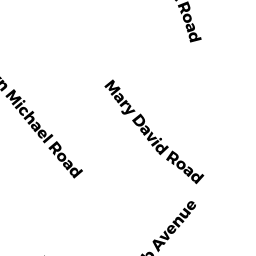
28 MARY DAVID RD UNIT 60A
Owner Information
BARRETT MARY ELIZABETH
28 MARY DAVID RD UNIT 60A
YARMOUTH PORT, MA 02675


Property Details
28 MARY DAVID RD UNIT 60A is classified as a CONDO NL MDL-0 (Condominium).
The primary structure on this property was built in 1975. There are 1,176ft2 of built area within this property. There is 912ft2 of residential/living space within this property.
28 MARY DAVID RD UNIT 60A is valued at $260,200. The land is valued at $0 and the structures are valued at $260,200.
The most recent deed for 28 MARY DAVID RD UNIT 60A is recorded at the local registrar in Book 33554, Page 185. 28 MARY DAVID RD UNIT 60A was last sold on Tuesday, December 8, 2020 for $270,800.
Assessment data from fiscal year 2022.
Flood Data
According to the FEMA National Flood Hazard Layer, this property does not appear to be in a flood zone. It may also be in an area not yet reviewed. Nonetheless, confirm this information prior to taking any action.
To view the flood hazards around this property, create a FEMA "Firmette" Map of the area around 28 MARY DAVID RD UNIT 60A.
Broadband Internet Providers
| Provider | Type | Bandwidth (mbps) | |
|---|---|---|---|
| Verizon New England Inc. | DSL | 5 | 0 |
| Viasat Inc | Satellite | 35 | 3 |
| VSAT Systems, LLC. | Satellite | 2 | 1 |
| HughesNet | Satellite | 25 | 3 |
| GCI Communication Corp. | Satellite | 0 | 0 |
| T-Mobile | Fixed Wireless | 25 | 3 |
| Comcast | Cable | 1000 | 35 |
Broadband service provider data from December 2020.
Adjacent Properties
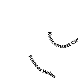
- 41 FRANCES HELEN RD UNIT 61A
CONDO NL MDL-0 owned by TAYLOR JANET L - 43 FRANCES HELEN RD UNIT 61B
CONDO NL MDL-0 owned by MEIGS RUSSELL F - 45 FRANCES HELEN RD UNIT 63A
CONDO NL MDL-0 owned by NOWICKI DAVID E - 47 FRANCES HELEN RD UNIT 63B
CONDO NL MDL-0 owned by KNAPP DAVID R - 32 MARY DAVID RD UNIT 62A
CONDO NL MDL-0 owned by DEGRACIA BRIDGET - 34 MARY DAVID RD UNIT 62B
CONDO NL MDL-0 owned by MUSCO ANTON - MARY DAVID RD
Undevelopable Residential Land owned by GARDENS ASSN INC